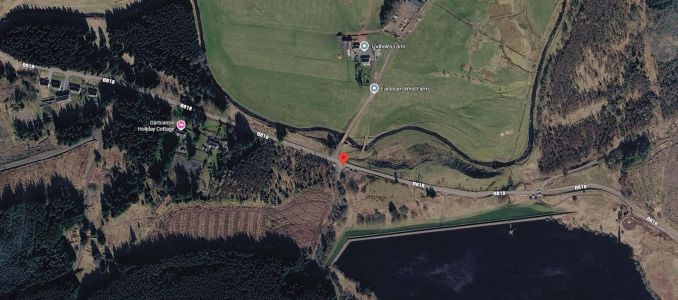
 (Click for bigger view and download)
Day Trip to the Gargunnock Hills
on Sunday 11 October 2026
Map required is LandRanger 57 Stirling & the Trossachs area,
but you can download a useful map section below ....
The October day walk is to Carleatheran (Marilyn, 485m), the highest point of the Gargunnock Hills north of the Carron Valley Reservoir.
We'll meet at 09:00 at the Meikle Bin (Todholes) car park on the B818, at the northern end of the Carron Valley Reservoir.
Satnavs: 56.04757, -4.13318 (the postcode is G63 0XH, but this covers a large area)
Maps: GR NS 672859
w3w: ///encroach.explored.expanded
(Click for bigger view and download)
From the car park, we'll take the track north past Todholes farm. This is also the access track for Earlsburn windfarm and much of our walk will use windfarm tracks to avoid ground which may be quite boggy. We'll keep following the track which ascends gently to its northern point. From here, the trig point on Carleatheran can be reached by following a rougher track for 500m. The return can be made by the upward route, but may be more interesting to follow the windfarm road south-westwards to around NS666896 from where we can return to the car park via the ruins at Burnfoot. There is a footbridge across the Burnfoot Burn at NS676881, although this is not shown on current OS maps.
The full route via Burnfoot is 16.5km with less than 450m of ascent and should not take more than 5-5.5 hours to complete.
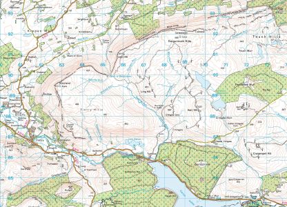 (Click for bigger view and download)
If you'd like to come along on this day walk, please email me by Friday 9 October and I'll organise cars/lifts as required. Please indicate if you would be willing to drive.
I'm happy to meet other walkers at the Uddingston Station Park and Ride at 08:00, but please confirm that you would like to meet there!
Cornel Brozio, Gargunnocks Organiser


